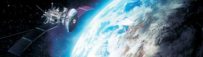
Space (Satellite & Stems)
 Experience :
TIECSS actively participates in the development of Satellite
Systems for ISRO
- More than 20 years. in lndian Aerospace industries
- Professionals with extensive background and expertise in the area related to the Development / Operationalization / Product Quality Assurance tor the Communication & Remote Sensing Satellites and Network Operations
- The cumulative experience around 1000 years
- Telemetry—Telecommand Systems.
- Attitude and Orbit Control Electronics
- Core Power Packages
- WVTA
- Digital Sun Sensors
- Power Distribution Packages
- Electronic Power Conditioners
- EED subsystems
- DC-DC Converters
- Analog Sensors
- Steradian Sensors
- Associated Checkoutunits
- EMl tillers.
- Satellite integration and I/F
- Launch vehicle Avionics subsystems
- Mini PCM Telemetrysysternsi
- Decoding Electronics tor Sequencing
- Mini Dual Power Modules
- Advanced Signal Processing Units
- Advanced Mission Computers
- Mini Remote Telemetry Units.
- HF-DC/DC Converters
- Image Data Processing Units
Facilities
- ISROcertified/qualifiedworkcenters
- Clean rooms
- ThermalChambers
- vibration & Shock Tables
- Radiation Shielding, Contormal Coating & Potting Facility.
- Wide Flange of Test and Measunng Equipment (Digital & Microwave)
 A strong R&D base in the multi disciplinary areas of its
involvement to ensure a continuous improvement end product
realization.
A strong R&D base in the multi disciplinary areas of its
involvement to ensure a continuous improvement end product
realization.Satellite Systems — Consultancy Services
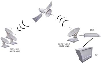
The TIECSS has expertise in providing services for satellite /operators covering all the phases of communication satellites. Consultancy services focus on both the space and ground segments of the communications satellite and include the definition of requirements up to and including orbital acceptance testing of the satellites
Conceptual Design Studies
Orbital slot selection, Associated rules and regulation, procedures to be lollowedrlike for ITU, Basic satellite definition, Satellite bus selection, Frequency bands of operation, No of transponders, EIRP optimization, Antenna pattern coverage, Optimum toot prints coverage interference mitigation methodology etc.
Market Studies
Business Plan Development.
Technical Support for : Products and Services, Applications
 Launch vehicle interface assistance
Assistance to launch vehicle interface activities. including
technical interface meeting during satellite development. satellite
integration at the launch site. and launch day monitoring and
support
Launch vehicle interface assistance
Assistance to launch vehicle interface activities. including
technical interface meeting during satellite development. satellite
integration at the launch site. and launch day monitoring and
supportSatellite interface assistance
Assistance related to satellite IF with LV and pre, LEOP, IO operations etc.,during the designated service lifetime
TIECSS has a high level of knowledge in the engineering of satellites and their operations. and as such offers consultancy and technical advisory services for the management of support projects for other satellite companies, organizations.
Clients
- Satellite Operators
- Satellite Manufacturers
- Satellite Service Providers
- Satellite subsystem suppliers
- Content providers etc.
With a view to harness its vast experience in the satellite technology and associated disciplines, and for meeting the growing demands of the communications transponders worldwide, TlECSS is presently worl its own— in close collaboration with reputed international global space partners to provide Broadcast, Telecommunication and value added services to the global community.
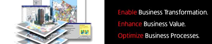
Geographical Information Systems
 TIECSS renders sen/ices in GIS database design and development, map
creation/ updation and finishing. data migration/conversion and
format translation, software development and customization. and
systems integration.
TIECSS renders sen/ices in GIS database design and development, map
creation/ updation and finishing. data migration/conversion and
format translation, software development and customization. and
systems integration.We are capable of various geospatial analytical procedures for users in agriculture. fisheries. market research, transport. electrical network. banking water supplies. sewage, forestry, flood management, hazard mitigation etc We help you in the process of cadastral mapping and change detection studies. We also provide 3D visualization and modeling services for hydrological. geochemical. hydro chemical or any other custom applications.
Our GIS team. with a skilful thematic mapping service. helps you display the spatial distribution of a single attribute or a specific topic. such as property assessments, soil types. or crime locations We offer comprehensive solutions for communications and utility companies to enable them to manage and maintain. distribute and transmit networks over large geographical areas, rural and urban. These include solutions and services for creating and updating digital geospatial databases with outside plant assets. overhead and underground, with logical connectivity representing the integrity of the networks.
We provide various utility mappings, covering the areas of gas distribution, transmission, electric distribution. transmission: telecommunications. cable and water/sewer
Digital Image processing of various satellite data products
- Geo referencing
- Ortho rectification
- Color balancing
- Digital Classification
-
Generation of Hybrid products
(Merging of various satellite data products) - Digital elevation model andlmagedraping Virtual GlS
- Aerial Triangulation and block adiustrnent
- Stereo Orientations
- Planimetric data corrections
- 3D feature extraction for Urban infrastructure services
- 3D city modeling
- Digital Elevation Model generation
- Generation Of contours
- Urban planning
- Ortho Photo generation for 2D mapping
- Ortho photo mosaicing
TlECSS range of GlS services apart from the ones mentioned so far include
-
Mobile GIS "C Navigational information,
like ambulance services. police patrolling,
vehicle tracking - Location-Based Services
- Public Safety
- Urban and Regional Planning
- Web-based and Systems integration services
- Digitizing & Setup
- Parcel Mapping
- Map Conversions
- Database setup / Preparation
- Updates and revision
- Raster to vector conversion
- Dynamic Segmentation of roads with classification
Introduction

TIECSS is an established one-stop shop for variety of engineering activities related to the defence sector. TIECSS has been exporting various goods across.